
Rail Corridor Asset Intelligence: Replacing Field Surveys with LiDAR
Client: Confidential Infrastructure Operator (Ontario)
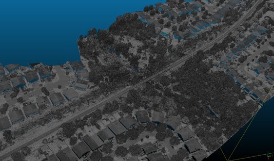
Figure 1: High-density Mobile LiDAR point cloud capturing the complex structural environment of a rail corridor.
The Challenge
A regional rail operator was preparing for infrastructure upgrades and electrification. They needed a highly accurate inventory of every tree along multiple kilometers of track to assess clearance risks.
Sending crews on foot (“boots on the ground”) to manually measure thousands of trees adjacent to active, high-speed rail lines is slow, expensive, and dangerous. The client needed to extract this data directly from mobile LiDAR surveys, turning massive, unreadable point clouds into clean, organized spreadsheets and maps.
The Solution
We developed a repeatable workflow to extract individual trees directly from the 3D data, eliminating the need for extensive field surveys.
- Data Cleaning: We verified the coordinates and stripped away sensor noise to create a reliable baseline.
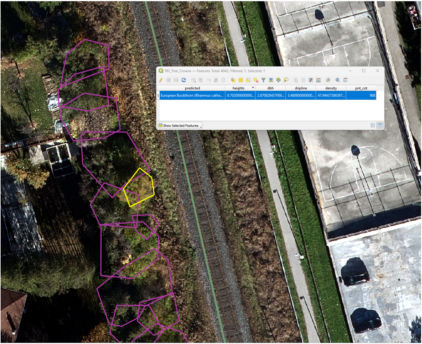
- Automated Tree Extraction: We utilized geometric analysis to automatically isolate and measure individual trees from the surrounding corridor environment.
- Clearance Metrics: For each identified tree, we calculated its height, estimated trunk diameter, canopy spread, and exact distance to the rail centerline.
- Asset Management Ready: We formatted all 3D measurements into standard GIS files that the client’s engineering teams could immediately drop into their existing software.
The Impact
We successfully translated raw laser scans into a decision-ready engineering dataset, drastically reducing field time and safety risks.
- Spatially Accurate Inventories: Every tree mapped with high precision, easily viewable in standard design software.
- Immediate Risk Identification: Segment-by-segment summaries highlighting immediate clearance hazards and structural encroachment.
- Future-Proof Baselines: Because the process is highly standardized, the client can fly the corridor again in three years and automatically calculate exact growth rates.
This project provided superior spatial intelligence, replacing slow manual labor with a safer, faster, and highly repeatable digital workflow.
Figure 2: Polygon segmentation of individual trees, displaying extracted tree metrics, species, and clearance distances.
Have a similar monitoring need?
If you have historical datasets and need clear, defensible risk intelligence, let's discuss a feasibility review.