A Logical Framework
for Risk.
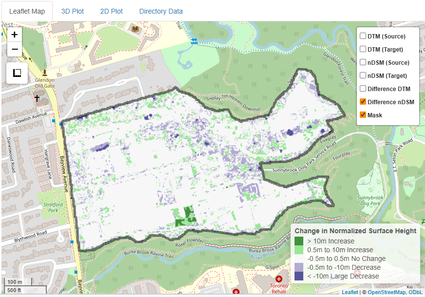
We transform massive point cloud datasets into actionable maintenance lists. Our three-stage pipeline ensures scientific rigor at industrial scale.
1. Identify
We begin with data normalization. We align multi-year datasets to a common grid, identifying systematic sensor drift and filtering out survey noise.
- • Geometric Verification
- • Error Modeling
2. Analyze
We isolate individual trees and corridor components from the scan to calculate precise structural lean, volumetric growth, and vegetation encroachment rates.
- • Individual Tree Extraction
- • Encroachment Modeling
3. Implement
We translate raw metrics into operational intelligence. You receive ranked inspection lists and risk maps formatted for direct import into your management systems.
- • Prioritized Maintenance Lists
- • GIS Hotspot Map Generation
Why this matters.
Raw LiDAR difference maps often flag false alarms due to changing sensor angles. Our precise extraction approach ensures you only send crews to locations where physical, structural change has actually occurred—saving time and operational budgets.